New walking connections for Two Mile Ash
The Bluebell Circuit
Detailed proposals – December 2019
1. Context, Aims and Benefits
This proposal for a new walking circuit for Two Mile Ash (TMA) – incorporating a footbridge and new woodland paths – is being put forward by the Two Mile Ash Environmental Group (TMAEG). Now in our ninth year, we are a not-for-profit community group with a membership of over 200 residents and four local businesses. Through our work we seek to safeguard and enhance the environment of Two Mile Ash to the benefit of all who live, work and use our facilities. We do this through practical landscaping and gardening projects, social events (eg talks, walks and visits) and Open Gardens, held bi-annually.
The Bluebell Circuit would be TMAEG’s biggest project yet. It would involve land in public ownership on the southwestern edge of TMA, most of which (the ‘green ride’ land and the greater part of the woodland ) is held and maintained by Milton Keynes Parks Trust. Currently, the potential of this land for public recreation is limited by the physical barrier of a steep-sided stream (designated by the water authority as ‘Watercourse M169’). By bridging that stream and creating the new walking circuit we can open up this green edge of Two Mile Ash for public amenity use, especially by TMA residents.
This project has been some time in the making. The case for joining up the green ride land was first identified by us in 2012 but it was some considerable time before we had the resources to investigate this any further. The present project was launched in September 2017 at our sixth annual meeting attended by over forty members; considerable enthusiasm was expressed. The original intention was to make this an MK50 associated project to celebrate the five decades of Milton Keynes, the largest of the UK’s new towns. For various reasons, principally our inability to secure a sustained input of technical advice and support regarding the design and construction of the stream crossing, the hoped-for 2018 start did not materialise. As this update on the project outlines, the intention now is to apply for planning permission in early 2020 and, subject to funding, to complete the project by the end of that year. The remainder of this section summarises the likely main benefits of the Bluebell Circuit.
In terms of lifestyle, the benefits to TMA and other users would be considerable. First, there would be the benefits to physical and mental health for many to be gained from the enhanced local opportunities for walking, a matter highlighted in a recent campaign by the Government agency, Public Health England This campaign extols the merits of a brisk ten-minute walk every day – this is the time that would be needed to complete TMAEG’s proposed walking circuit.
Second, in terms of well-being, our community would gain proper access to a fine Norway Maple plantation established some forty years ago, with the added attraction in spring of the swathes of English bluebells that were planted here. Indeed there are many different wildflowers to be found along the different parts of the Circuit and this increased exposure to the changing faces of nature will enrich people’s enjoyment. The footbridge and the views along the watercourse that this infrastructure would open up promise to be features of interest in their own right.
Third, the new connection would provide another physical link between the Fairways area and the streets to the south of the High Street, for example, Milesmere; it would also connect to other walking routes within TMA, expanding the range of walks available and the possibilities for a regular stroll.
Fourth, the enhanced scope for local recreation and the enjoyment of nature provided by this scheme would reduce the need for residents to seek these benefits elsewhere. As in practice most such journeys would be by car, there would be associated reductions in carbon emissions.
Overall, these gains would be considerable. They would be long term benefitting both ourselves and future generations and they would be achieved at an estimated total cost of £15,000, representing extremely good value for money. We see the new infrastructure represented by the bridge and the new log paths as fitting additions to the amenities of Two Mile Ash and a contribution to our city’s greenspace use as a whole as Milton Keynes enters its second half-century.
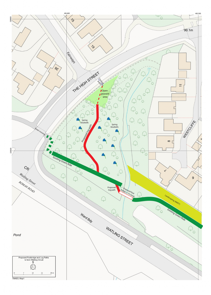
Map 1 (below) shows the location of the proposed bridge and the paths that would be linked to it.
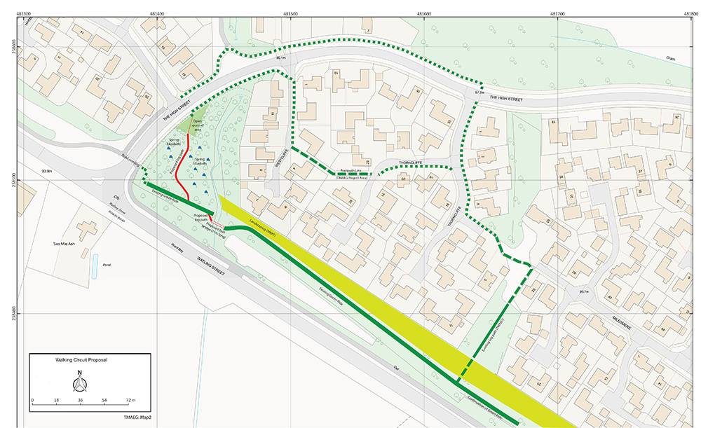
Components of Circuit Map 2 (above)
The circuit (of about 0.75km or half a mile in length) would be made up as follows:
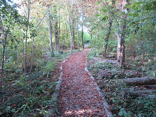
An existing log and chippings path that passes through the woodland between Milesmere and Thorncliffe. This was constructed by TMAEG, based around a pre-existing track – and has been managed by us for the past five years.
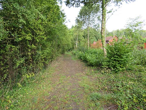
The existing ‘green ride’ running northwestwards parallel to Watling Street and as far as the existing stream.
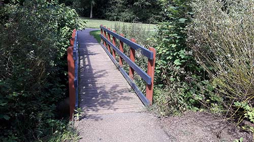
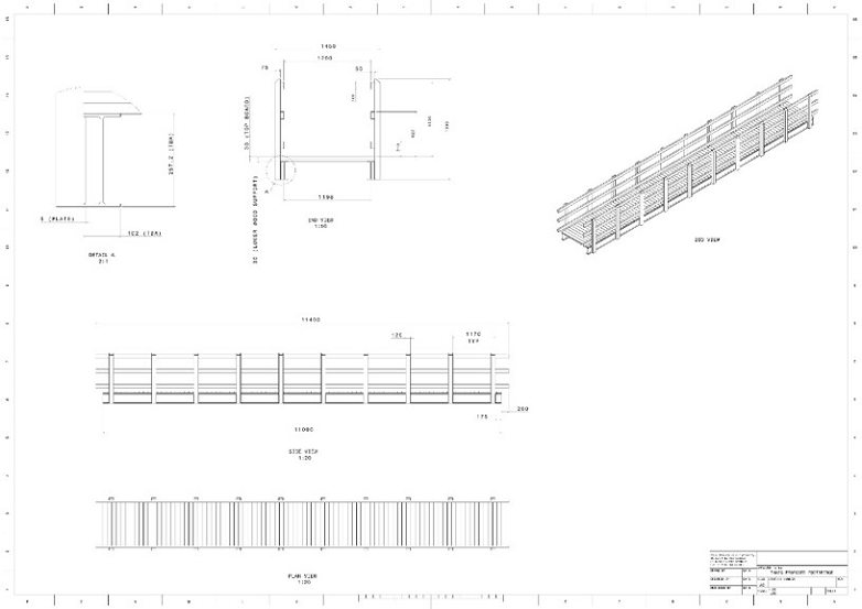
A new footbridge (this is a footbridge in Emerson Valley Linear Park, similar to the proposed bridge), that would cross the stream, joining with a short section of new log and chippings path connecting with. . .
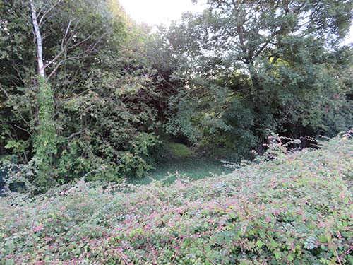
. . .the continuation of the green ride reaching to the junction of TMA High Street with Watling Street. And diverting from this. . .
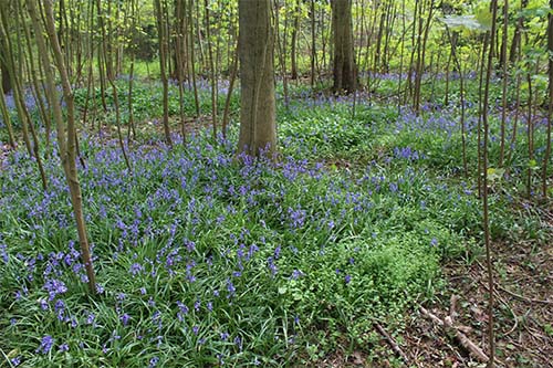
. . . a new log and chippings path to be built by volunteers through the woodland to the west of the stream. This would pass to the west of the main bluebell area…
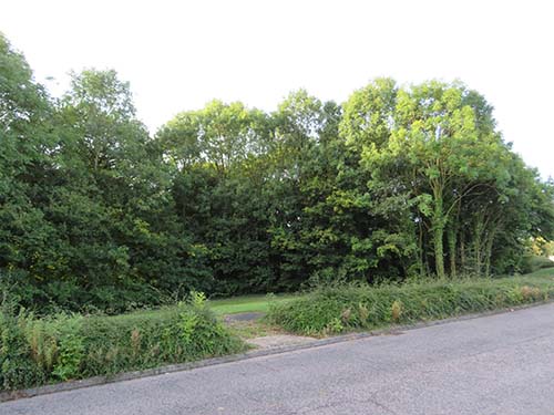
…emerging onto the green directly opposite Fairways.
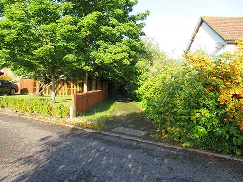
Local streets and footpaths would complete the circuit.
In terms of the wider links, walkers using the new circuit would be able to connect with the Fairways area via: the footpaths serving that distributor road and its five cul de sac (Fig.8 below) . . .
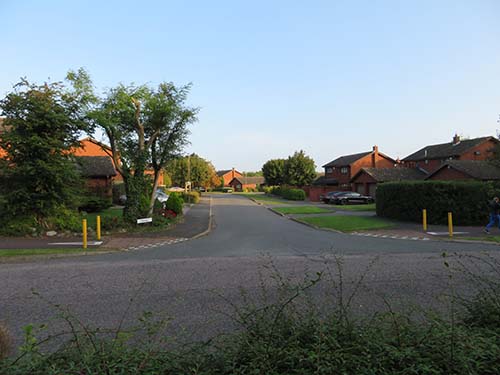
Fairways
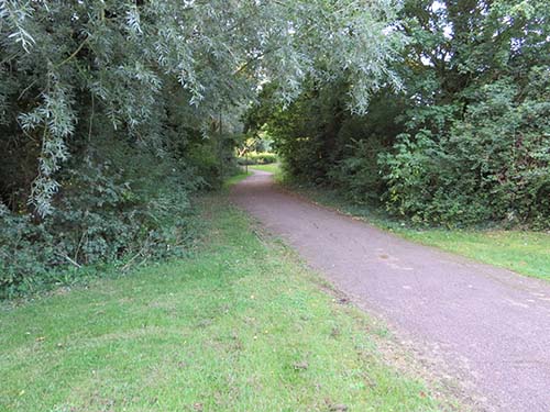
. . . the section of green ride running between The High Street and the western corner of TMA at Monks Way H3 (Fig.9 below). . .
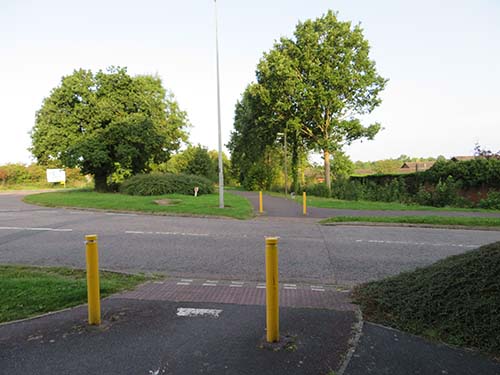
Green Ride
. . . and, along the eastern edge of the area, the Redway connecting The High Street with Kiln Farm (Fig.10 below).
Redway
To the east, from the junction with the Milesmere woodland path, walkers can, as now, follow the green ride towards the southern corner of TMA and from that area there is access to the street network.
3.The Footbridge
Following discussions with the Parks Trust, we originally looked at two technical options for the stream crossing, a conventional footbridge and a culvert solution, in which the stream flow would be accommodated in a wide pipe embedded in concrete, this forming a base for a bridge deck spanning the two banks. The advice we were given was that, while both options would be feasible, a conventional footbridge would be less expensive; this was on the basis of a relatively light structure that would not need elaborate, deep foundations.
Under our present proposals, a bridge deck 11m in length would be installed on concrete footings on each of the two banks; these have been specified by us following consultations with a structural engineer. The bridge superstructure would be constructed for us by the Parks Trust to a standard design used in many of the City’s parks. For robustness and longevity, the deck would be built around steel beams. With an internal width of 1.2m the bridge would accommodate motorised disability scooters and wheelchairs as well as pedestrians. We have earmarked a siting that would place the crossing well away from the line of a marked gas main and also direct pedestrian traffic away from residential properties (Map 1).
4.Planning
Assessed as a planning proposal, we believe that the walking circuit would be of substantial overall benefit to Two Mile Ash (Section 1) and that any adverse impact would be low and able to be mitigated. As well as planning approval, consent would also be required from the Internal Drainage Board but from initial conversations with their staff we do not foresee any significant difficulties.
4.1 Residential use and impacts
We have looked at the likely impact of the circuit on residential amenity. Once it ceases to be two mainly ‘dead ends’ interrupted by the watercourse, but part of an attractive footpath network, we would expect the use of this section of the green ride to grow significantly from its present low level. Based on our observations of the use of existing footpaths in TMA, and of walking patterns throughout the day and at week-ends, we think that a reasonable expectation for year one after opening would be for an average of 100 users per week. One might expect this to build up over the years as the walk and its qualities in terms of wildflowers and other wildlife, and the opportunities to combine the circuit or parts of it with other walks become better known. This is something that TMAEG will seek to monitor.
In terms of impacts, the green ride part of the route runs parallel to the rear boundaries of nine properties served by Milesmere, Thorncliffe and Westcliffe and there is a wide landscaped buffer strip between the walking track and those rear boundaries; this provides a significant degree of screening. Its outer edge is to a large extent defined by an evergreen hedge. The strip is a minimum of some 9m deep, extending to some 20m depth at its southeastern end. Subject to detailed technical work the footbridge itself would be set a minimum of some 18m away from the closest property boundary and the path leading to it would diverge away from that boundary (Maps 1 & 2) .
Those living in the nine properties cited above plus a further five backing onto the eastern boundary of the woodland were consulted about the proposals as part of a month long residents consultation following the September 2017 launch. There were two objections, one from each of these two groups of housing but also expressions of support from two other households, again, one in each of these groups. The other part of the consultation involved the TMAEG membership as a whole and the feedback has been strongly in support of our proposals. There will be a further opportunity for people to comment as part of the planning application process.
We have looked carefully at the specific impacts on all the neighbouring properties Given the distances involved and the extent of landscape screening, we do not think that the bridge and those crossing it would be visually intrusive in views from the closest houses and neither do we feel that it would impinge on the privacy of those occupants to any significant extent. Moreover, we do not consider that the increased use of the green ride would significantly affect the amenities of neighbouring residents.
The main new woodland path would branch off from the continuation of the green ride to the north west of the bridge, to follow a curving route around the western margin of the bluebell area. Properties on the western side of Westcliffe, that back on to the woodland, would be protected from intrusion from users of that path by the distance involved, coupled with the barrier presented by the stream in its deep channel.
It would be our expectation that the attraction of more regular use to the existing green ride paths by those who are genuinely seeking to enjoy them would bring with it a self -policing element that would deter misuse.
4.2 Ecology
We have sought to minimise the effects of our proposals on existing mature trees. Regarding the line of the main log path that will pass through the Norway Maple plantation to emerge on the green opposite the entrance to Fairways, it will pass around the trees and avoid the main areas of English bluebells. We envisage that the only losses will be in respect of the Field Maple trees at the stream crossing points. Following discussions with the Parks Trust we expect that just three of these trees would need to be felled to accommodate the proposed footbridge. Of these, one shows significant rot at its base and another leans at a steep angle, to a degree likely to affect its stability in future years.
Otherwise we will work to maintain and enhance local biodiversity at our existing sites along the Bluebell Circuit, notably the Milesmere/Thorncliffe woodland where we are creating glades on either side of our log path and planting these with native species including primrose, English bluebells and wild anemones. To the same end, we will seek to work with the Parks Trust on adjoining land within their ownership.
We note that the Norway Maple plantation is defined in the Parks Trust Biodiversity Action Plan 2016-2021 as a specific habitat type (HAP02 Plantation and Planted Woodlands) where specific conservation management objectives are to be applied. TMAEG will seek through its volunteers to work with the Parks Trust on the realisation of these objectives.
4.3 Hydrology
Watercourse M169 is in a deep channel and the footbridge would cross it at the top of the stream banks well above the water level. While rain water run-off from the bridge deck – and how it is channelled – will need to be considered we do not consider that the structure would have any noticeable impact upon water flow in the stream below. Moreover, the crossing would be within a straight section of the channel meaning that scour should not be an issue. The watercourse originates on land to the west of Watling Street where the new residential district Whitehouse is currently under construction as part of a major expansion for Milton Keynes. We note that drainage outflows will pass through a sustainable urban drainage SUDs) system that will maintain current water levels along the stream.
5.Management
The principle that TMAEG has adopted for all its environmental schemes is to look after them once they are in place. In this area we already carry out such maintenance along the Milesmere & Thorncliffe woodland path and we would be happy to discuss similar arrangements with the Parks Trust for looking after the new log paths. We are currently considering the idea of a TMAEG presence along the route, through a rota of TMAEG volunteer wardens completing at least one circuit during their rota day, engaging with users, and taking limited actions or reporting matters to TMAEG as necessary.
6.The Next Stages
We propose to apply for planning permission in early 2020 following completion of detailed design work on the bridge and its foundations. We will then seek consent from the Internal Drainage Board. Subject to those consents being granted, and the availability of funding we will proceed with the various elements of the scheme.
CJG 11/12/2019
- New walking connections for Two Mile Ash
- Ideas for the Central Landscape Strip (Dec 2011)
- Traffic and Parking in Two Mile Ash (Dec 2011)
- Two Mile Ash School – Consultation on the Proposed Expansion (May 2013)
- Planning Application to expand Two Mile Ash School (Representation 1- January 2014)
- Planning Application to expand Two Mile Ash School (Representation 2 – Response to Transport Statement and School Travel Plan – March 2014)
- Planning Application to Expand Two Mile Ash School. (Representation 3 and Message to Members of the new Planning Committee June 2014)
